Genuine mountain experiences in the hiking areas of Rauris Valley and Taxenbach
Hiking Map


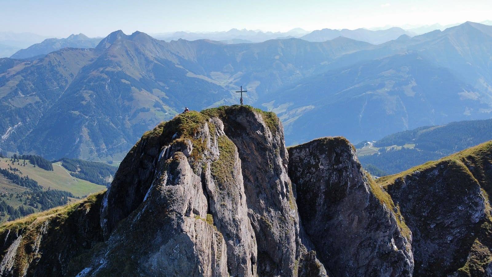
With over 295 km of marked hiking paths and alpine trails in Rauris Valley as well as 70 km in Taxenbach, this SalzburgerLand region is one of the biggest and most diverse hiking areas in Hohe Tauern National Park.
Pleasant hikes across lush alpine meadows to your next refreshment stop at one of the managed mountain huts, instructive theme paths as well as challenging ascents of 3,000-meter peaks. Past springs and waterfalls, to genuine natural jewels such as Rauris Virgin Forest, the Rauriser UrQuell or through Kitzloch Gorge, past evidence of gold-mining days, birds of prey circling high above your head, to vast vistas out across yet more amazing peaks ... mountaineers and hikers face practically limitless opportunities in Rauris Valley and Taxenbach. Hiking in Rauris Valley means active recreation and unforgettable experiences in the heart of Hohe Tauern National Park! So, pack your rucksack, slip on those hiking boots – the mountains are calling!
Hiking Routes Theme Paths Hiking map Raurisertal Current Weather Tours of the Nationalpark Hohe TauernThe certified mountaineering and hiking guides in Rauris Valley are always more than happy to assist, helping you to design a mountain tour commensurate with your alpine experience.
5661 Rauris, Österreich
Tel.: + 43 664 415 39 23
E-Mail: w.rohrmoser@bergwolf.at
Web: www.bergwolf.at
Tel.: +43 664 45 83 536
E-Mail: gerlinde.eidenhammer@rauris.net
Tel.: +43 650 8824884
E-Mail: martin@schermtax.at
Web: www.schermtax.at
Hiking guide, Nationalpark Ranger, Rrail Running guide
5661 Rauris, Österreich
Tel.: +43 664 7870911
E-Mail: armin.wanke@hotmail.com
Hiking guide and Nationalpark Ranger
You can find all hiking and bike tours and places of interest at the Social Activity Network Tourispo.com. There you can share and create your favorite places of the Raurisertal.